
Throughout history, breakthroughs were made when bold people were equipped to make well-informed decisions.
What separates data from knowledge is what you do with it. That’s why for 20 years, NOMADICS has led the way for progress by applying exceptional GIS data and technology solutions that create clarity for decision-makers and help mitigate risk. Because no one can move forward without a clear path.
These public, private, and defense innovators have chosen to follow our leadership. They chose to follow NOMADICS.


SeaPort NxG
SeaPort NxG is the Navy’s electronic platform for contracting support services and ensuring small business participation.
NOMADICS is a Prime NxG contract holder for engineering services.

Navy UxS
For more than a decade, NOMADICS has provided safety, reliability, availability, and maintainability engineering for the Naval Unmanned Systems portfolio.

Government Capabilities & Competencies
NOMADICS works collaboratively with Federal government clients to build and model systems that produce intelligent infrastructure, state of the art defense solutions and safer, efficient, and economical operating environments.
NOMADICS GIS R&D on ArcGIS Online (AGOL)
NOMADICS utilizes the latest GIS technologies to produce deliverables such as planning and strategy tools for various clients and R&D efforts. Live samples of our web applications and dashboards are available on ArcGIS Online.
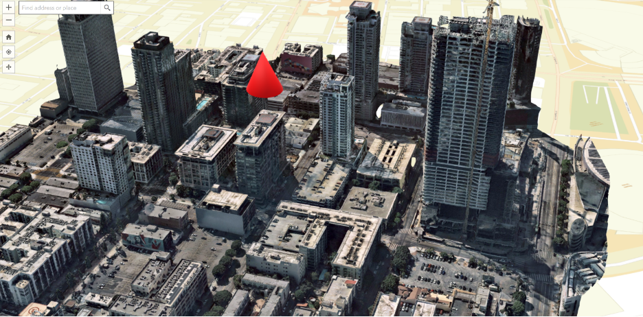
Telecomms Network Upgrade
A multinational telecommunications conglomerate requested the topographic and structural capabilities of NOMADICS to remotely sense and collect spatial intelligence on 5G network upgrades. NOMADICS produced 2D and 3D maps and models to support strategy and implementation planning.

BP Deepwater Horizon MC 252
In 2010, NOMADICS set up a boots-on-the-ground presence in Louisiana to assist in cleanup operations in the Gulf of Mexico following this industrial disaster. We created realtime maps for unified command, allowing response leaders to forecast the locations of surface oil, catalog contamination and response units, and plan for efficient operations.
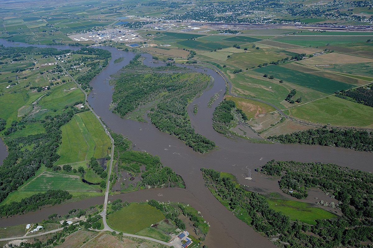
ExxonMobil Silvertip Pipeline
NOMADICS turned personnel into data points to curb the spread of oil into the Yellowstone River in 2011. By aggregating and coordinating smart phone information and observational reporting from Shoreline Cleanup Assessment Teams in the field, our GIS analysts were able to build a real-time map depicting the status of cleared and oiled debris following the pipeline leak.
NOMADICS is a highly motivated team that provided high quality GIS mapping services for thousands of proposed rehabilitation and reconstruction projects. The team is responsive, flexible with changing priorities and data reporting requirements, and unpredictable volume.
Kristine Sinkez, NERIS

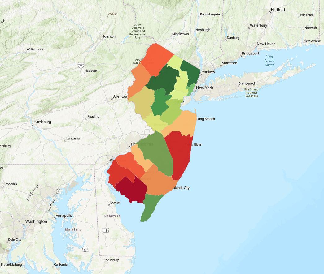
Connect to Walk and Bike
When Morris County envisioned a pedestrian network across the NJ Township of Dover, they turned to NOMADICS to connect the dots. Our experts combined in-field audits with precise demographic data to develop thorough assessments and recommendations that changed the way people connected with their community.
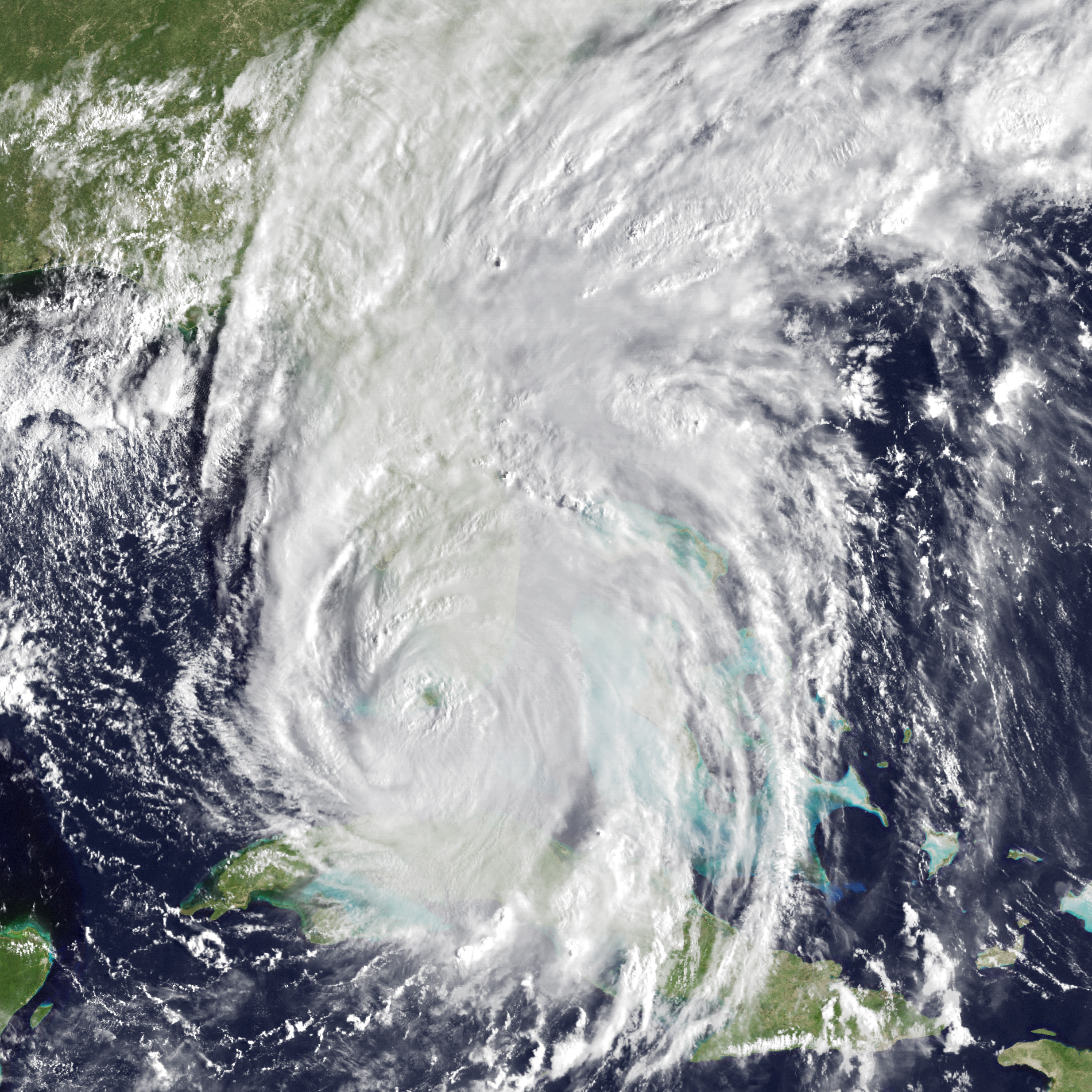
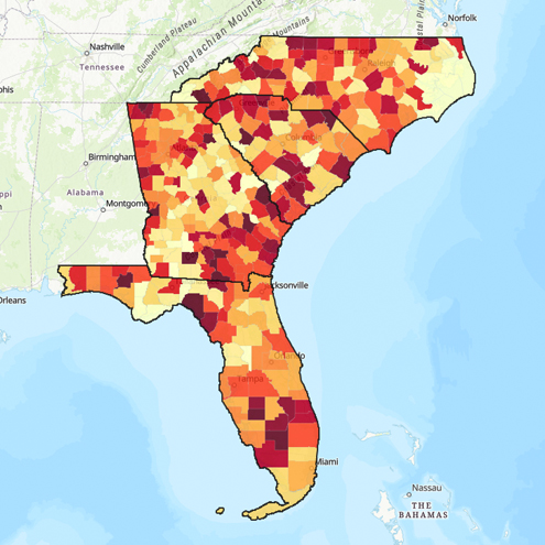
Rebuild Florida
In the wake of Hurricane Irma, NOMADICS provided crucial intelligence to inform Florida’s long-term economic development, housing, and infrastructure recovery efforts as part of the Florida Department of Economic Opportunity’s Rebuild Florida program.
Project: Sure Shot
For nearly three years, our interactive knowledge-management tool helped state response teams, health commissioners, and governments make real-time decisions regarding the spread of COVID-19. NOMADICS deployed 8 dashboards featuring hotspots, case counts, and deaths, integrating with testing sites, hospitals, and pharmacies so public officials can make life-saving decisions.
Follow NOMADICS for your next project.
Project: Broad Street
Nominated for an ANJEC Environmental Achievement Award, NOMADICS built a database-driven interactive COVID-19 map to arm New Jersey officials with case and death trends, vaccination rates at the county level, and locations of COVID-19 vaccination sites. The web application was expanded to include tools for 10 other states until the end of the first phase concluded in 2023.
Project: Thor
What would it mean for your business or project to have access to an interactive dashboard that shows where all of your assets, workers, or fleet vehicles are–in real-time? The R&D Team at NOMADICS has made it possible with a phone-based tracking data visualized in an easy-to-use GIS platform.

Madison’s Stormwater Modernization
When critical infrastructure data is outdated, how do you maintain alignment and public trust? NOMADICS helped the Borough of Madison update and streamline its stormwater GIS records, delivering accurate and functional data to support future planning.