
When ambiguity is not an option.
Since 2006, the subject matter experts at NOMADICS have been utilizing Geographic Information Systems (GIS) and Information Technology to support a diverse range of decision-makers and stakeholders. Our solutions have led the way for progress in operational planning, resilience, and sustainment.
- Logistics
- Chemical, Biological, Radiological and Nuclear (CBRN) Identification
- Tracking, Modeling, and Countermeasures
- Infrastructure Resilience
- Telecommunications
- Mapping, Disaster & Emergency Response and Preparation
- Environmental Monitoring
- Real Estate, Insurance, Transportation, Socio-Demographic, and Economic Simulations
- Realtime Asset Capabilities & Data Visualization
15+
Years in Operation in Public, Private, and Defense Sectors
30 Days
Or Less to Assemble a Bespoke Team of SMEs from our National Network of Strategic Partners
1024
Terabytes of National Geospatial Intelligence Data available for Nomadics Clients and Partners
How We Partner
Staff Augmentation & Technical Pipelining
- Traditional FAR- or AMS-based Service Contracting
- Providing personnel for:
- Senior Engineers
- Journeyman Engineers
- Junior Engineers
- Technicians
- Logistics Analysts
- Financial Analysts
- Programmatic Analysts
- Acquisition Analysts
- Other Functions
- Options for customers to hire junior-to-mid-level engineering and technical/scientific staff prior to using a Direct Hire Authority to in-source
- Recruiting from local engineering universities, technical colleges, and government STEM programs
Solutions Provider
- A vendor- and product-agnostic solution provider
- Identify technology and product insertions to provide the best solutions to meet the customer requirements
- Partnering strategy focused on creating high-performing teams capable of delivering complete lifecycle solutions
- Access to prototyping projects and Other Transaction Agreements (OTAs) through our 20+ consortium relationships, including SBIR, DOTC/NAC, C5, SOSSEC, and more.
Our partnering strategy is focused on creating high performing teams capable of delivering lifecycle solutions that bring our clients value, solve tough mission challenges, and extend the state of what’s possible.
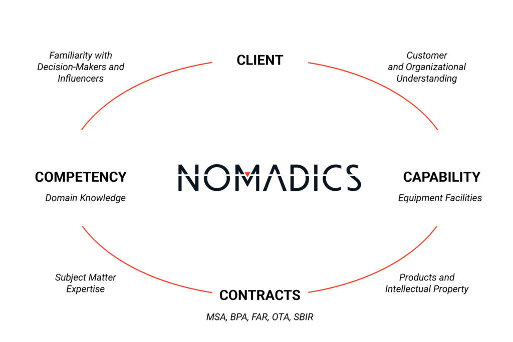
Partnering Factors
- Nationwide Presence
- Unique Capabilities
- Unique Products
- Alignment with Socio-Economic Goals
- Customer Knowledge
- Contract Vehicles
- Talented People
Partners Sought
- Manufacturing (All Types)
- Agile Software Development
- DoD R&D Focused
- Industrial and Defense Cyber
- Agency-Focused Service Companies
- Technology-Focused Product Companies
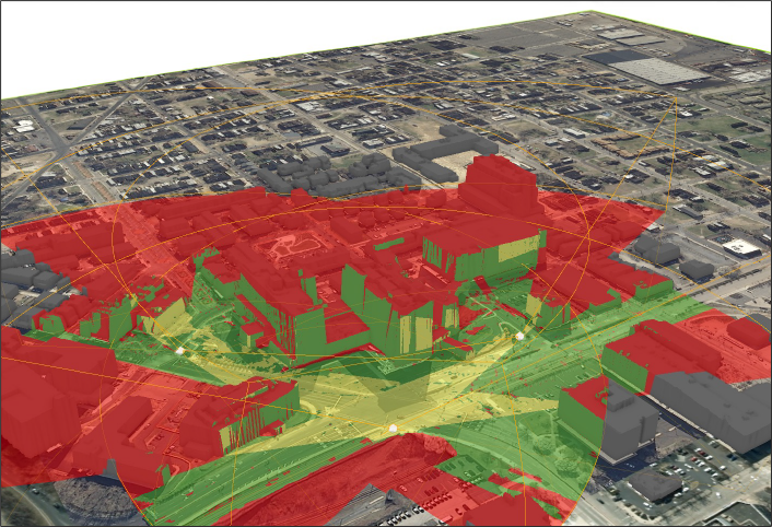
Geospatial Intelligence, Digital Information and Data Analytics
Better decisions are made from actionable truths. Our trained and certified professionals have significant in-field and in-lab GIS experience developing custom solutions to our clients’ needs on the industry’s leading technology platforms. We turn geospatial data into geospatial intelligence.
- Geospatial Data Services
- Geospatial Data Creation
- Cartography
- Geospatial Administration Management

Engineering and Technical Services
Your complex problems, solved. Our full service data analysis and strategy has empowered public, private and defense clients to see new ways of planning, managing, predicting, analyzing, and resolving unique engineering and technology challenges.
- Safety Engineering
- Reliability Engineering
- Availability Engineering
- Maintainability Engineering
- Risk Assessment
- Incident Assessment and Management
- Incident Command Systems
- Mitigation Strategy Recommendations
Research and Development
With an on-staff team of designers and production engineers and a robust network of manufacturing partners, NOMADICS is uniquely equipped to make innovations real. From prototypes to short-run components to proprietary software, our solutions are crafted for the individual needs of our clients.

Leading the Way for Progress
NOMADICS has created exceptional GIS data and technology solutions for dozens of innovators in public, private, and defense sector organizations across the United States and internationally.