Connect to Walk, an initiative of the Morris Park Alliance and the Morris County Park Commission, had a vision for a county-wide walking and biking system that would connect the active public to parks, community centers, schools, and transportation locations. In order to make that vision a reality, the Morris Park Alliance needed a clear assessment into the county’s current demographics, resources, amenities, and infrastructure to craft an impactful recommendation for County. For that, they turned to NOMADICS.
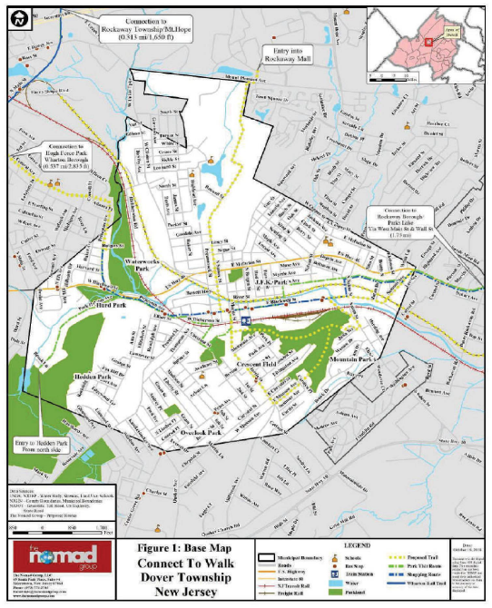
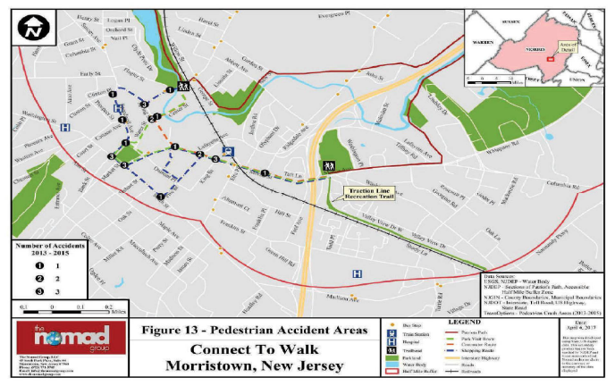
Starting in 2016, NOMADICS built a project team including GIS students from Montclair State University working hand-in-hand with our subject matter experts. One major area of focus was the bustling Township of Dover, which not only boasts abundant parks, water bodies, roads, railroads, bus stops, train stations, and schools, but also reflects economic and demographic diversity and a strong commuter population.
By aggregating layers of GIS and demographic data with walking audits, windshield surveys, and community outreach, NOMADICS was able to develop a suite of maps to help the Morris Park Alliance understand the community needs while optimize commuting and physical activity options, sidewalk properties, and traffic safety measures.