
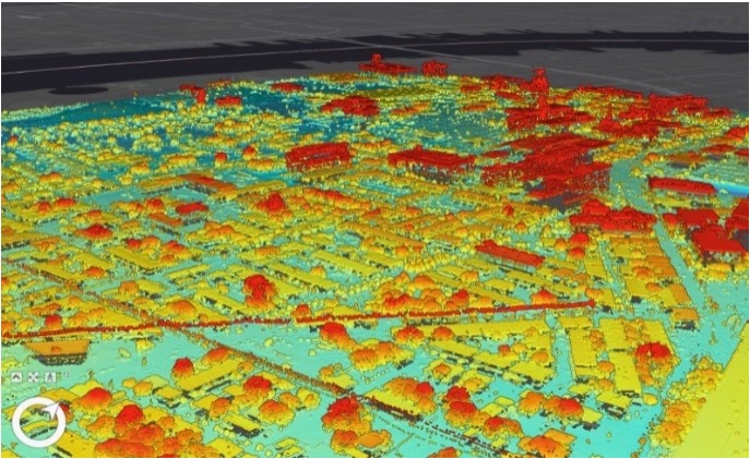
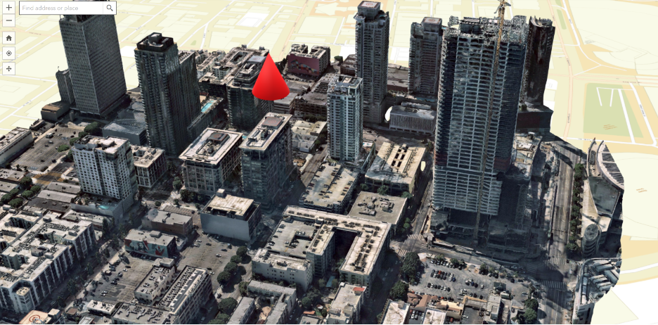
In 2022, a multinational telecommunications conglomerate requested the expertise of NOMADICS to remotely sense data to collect spatial intelligence on 5G network upgrades and produce actionable maps and models. We used LiDAR data (Light Detection and Ranging) and aerial imagery acquired using fixed-wing aircraft to create realistic 2- or 3-dimensional maps and models of a 5G proposed project location. The results of the spatial analyses performed include the development of building models, transportation logistics and a viewshed analysis to estimate signal penetration and implementation planning. Our cartographic process, advanced equipment, and technological capabilities can be used for analysis in any area of customer interest to evaluate source data and research, analyze, select, and prepare superior cartographic materials for static, dynamic, and interactive maps as well as 3D models.
Our teams developed a proprietary data model and transformed it into actionable intelligence based on specific stakeholder requirements. We leveraged our well-established relationships with our data partners (NOMADICS supply chain companies, government agencies, and private sector businesses) to develop hybrid photogrammetry/LiDAR derived 3D models that have highly accurate spatial and temporal characteristics—within a cm2—that best represent the real world in which we live. Preferably, these models are provided to our clients as a dynamic data package that is frequently updated and maintained via a Collaborative Research and Development Agreement (CRADA).
NOMADICS 3D Services
- Light Detection and Ranging (LiDAR)
- Aerial Imagery Acquisition
- Data Processing
- 3D Topography Model Development
- 3D Structure Model Development
- 3D Underground Model Development
- Remote Sensing, Spatial, and 3D Analyses
- Viewshed Analysis
- 3D Model Maintenance
LiDAR uses fixed lasers and light to take measurements. Photogrammetry uses pictures to do the same.
Using both is a must to provide 3D Modeled results for informed decision making.
Comparing LiDAR and photogrammetry, one technology is not better than the other. They both have their applications, and they also have their limitations. Our expert analysts at NOMADICS understand the differences in approach as well as the capabilities and limitations of the two technologies. For our telecommunications partner, we were able to make an educated recommendation based on their business needs, cost requirements and an ROI projection. Both LiDAR and photogrammetric accuracy is based on having a highly stable point cloud reference for surveying buildings, infrastructure, and raw land.
LiDAR can collect more detailed and in-depth information than photogrammetry in some cases, but photogrammetry includes more detailed visual information on the environment that is indispensable for many of our clients. There is a distinct difference between the deliverable from LiDAR data and photogrammetry. While both can generate point clouds and 3D models, the LiDAR data is often of significantly less resolution and lacks the color information provided by a traditional RGB camera.
Not all LiDAR and photogrammetry is created equal. The frequency of updates and quality of compiled LiDAR and photogrammetric data is the key to accurate utilization. For accuracy, our clients cannot us LiDAR data which is provided to the general population and housed in the public domain, nor can they rely on or solely use 2D scans from an air/ground-based LiDAR data capture system.
Our tools and techniques utilize a combination of these technologies and allow us to measure the temporal accuracy of the data used in these models in terms of days and months rather than years or even decades. Also, publicly available data collections are narrative-driven by state and federal projects which are usually focused on very specified metrics. This often results in medium to low resolution LiDAR point clouds representing “leave off” conditions around areas identified as posing some hydrologic risk, such as rivers and in coastal areas. This makes for patchy collection coverage areas with different resolutions, and additional assumptions needed for manual model edits to come closer to real world conditions. This is most evident when comparing building facades and tree canopy. Although both LiDAR and photogrammetry can be useful, a hybrid technology solution is the best approach.
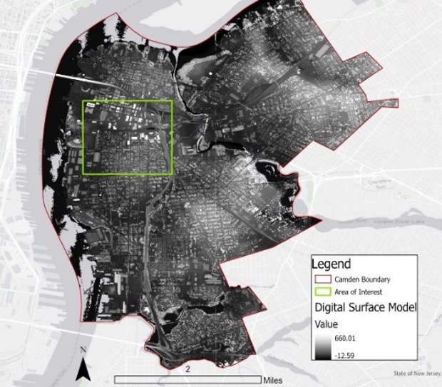
The data formats we focus on include high resolution photo-realistic 3D meshes, digital surface models (DSM), digital terrain models (DTM), aerial/ground-based LiDAR and point clouds. Additionally, by using a hybrid technology solution we leveraged the high resolution ortho (overhead) and oblique (side views) imagery of targeted study areas that are used to create the 3D mesh environment crucial for this telecomms client. Using a combination of these data inputs, we have been able to accurately analyze locations for quality and quantity of infrastructure suitable to support new equipment, evaluate potential obstructions for signal penetration, evaluate building façade and window placement, and perform 3D analyses to evaluate line of site and viewsheds over large areas. We can also simulate new infrastructure development and run a scenario analysis in the 3D environment. Moving forward, we are evolving the model to include suitability and vulnerability analyses that consider both physical environments and socio-economic data, spatial statistics to analyze clusters of points of interest, and custom web mapping applications and dashboards.
Data Accuracy
| Data Type | Accuracy |
|---|---|
| DEM | 28 cm |
| DSM | 15 cm |
| Point Cloud | 30 cm |
| Textured Mesh | 15 cm |
| Ortho Imagery | 5 cm |
| Oblique Imagery | 8 cm |
| LiDAR QLO-QL3 | 5-20 cm |
NOMADICS provides data in both a raw format—which requires specific geographic information system (GIS) software— and in the form of web-based interactive mapping applications. These web applications are fully customizable to meet the needs of our clients and their specific standards of accuracy. Unlike most data procurement specifications, which largely focus on the products derived from LiDAR data such as the bare-earth digital elevation model (DEM), we built our models to the specification of the U.S. Geological Survey National Geospatial Program (USGS-NGP) 3D Elevation Program (3DEP). This specification emphasizes the source LiDAR data to ensure that the complete source dataset remains intact and viable to support the wide variety of DEM and non-DEM science. The data informing the model for this telecommunications client meets/exceeds the National Enhanced Elevation Assessment specifications (which is the minimum standard established by the U.S. Government for accuracy and quality of work).
The data and models that NOMADICS built and managed for this telecomms client allowed the organization to build a strategic position for long-term customer retention, exceeding the project’s expectations. As a result, NOMADICS is currently negotiating a series of sole-sourced contracts for initial builds and continued operations and maintenance over the next 5 years. Furthermore, we have solidified a potential company-wide consulting contract and been asked to use our background in radar work to map the interiors of buildings for additional telecommunications requirements.