
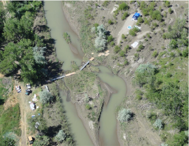
On the first of July 2011, the Silvertip Pipeline running near Laurel, MT, ruptured, releasing thousands of gallons of crude oil into the Yellowstone River. Within days, NOMADICS was on the ground at the Incident Command Center in Billings to provide Specialized System Technical Planning and Operations, as well as GIS analysis and ecological support.
Our experts worked diligently with the United States Coast Guard, ExxonMobil, USEPA, USFWS and private contractors to coordinate and develop the protection, recovery and rehabilitation strategies for the breach. This included but not limited to: daily development and/or analysis and/or utilization of data and projections for situation overview projections, public information officer data, USFWS endangered species surveys, S.C.A.T. (Shoreline Clean up Assessment Teams) maps including tracking location and monitoring status of onshore protection and cleanup operation data, maps, strategy for rapid assessment, heavy and light clean up, and post assessment teams, Land Ownership & Access database and mapping development and implementation, S.C.A.T./USFWS data management, oversight, QA/QC, and development of Combined Treatment Recommendation data and mapping for clean up implementation.
To capture realtime data without slowing containment efforts, our technicians utilized geolocation data and observational reporting from the iPhones of the Shoreline Clean up Assessment Team members to instantly map cleaned and oiled debris areas.
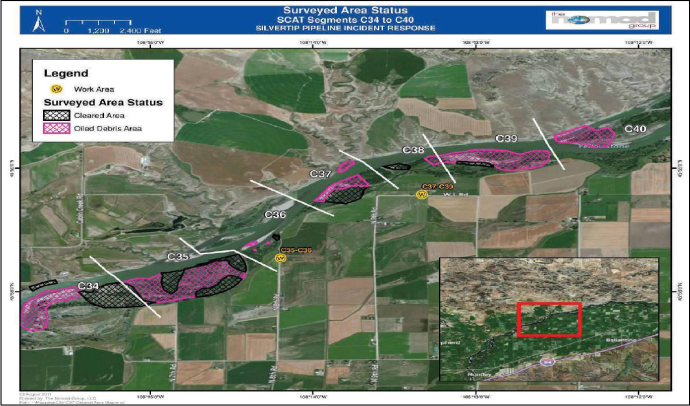
The iPhones were connected to the response’s overall GIS server, in which GIS analysts in the response’s command headquarters and various forward operations bases would review, analyze, and edit the topology of mapped features and incorporate additional attributes (such as area, comments, and dates) into the mapped features.
Afterward, the surveyed areas and their attributes would automatically be displayed in an overall viewer that would allow for response leaders to track response progress, determine future cleanup planning and asset allocations, coordinate personnel movement, maintain a living history of contamination landfall and response operations, and provide an active communication channel with live updates to unified command.
NOMADICS also contributed to the EHS adjustments for field ecologists and remediation crews pertaining to daily land and river field operations of surveying, assessment, macro/micro scale oil remediation and the collection, transporting, and handling of both oiled and non-oiled aquatic, terrestrial and avian wildlife, GIS field data, and contamination samples.